For over a week, Hurricane Florence dominated the attention and conversations of people across the Carolinas and beyond. If you were not glued to the wall-to-wall television coverage of the impending storm, then you were probably connected to social media for the latest storm predictions and coverage.
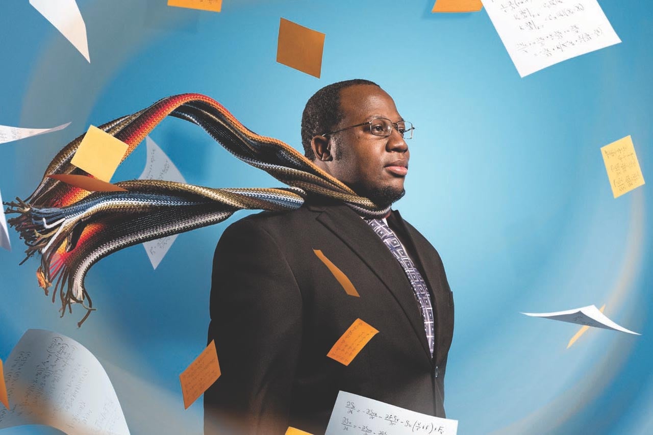
![]() College of Charleston atmospheric physicist Gabriel Williams was also tuned into the coverage. As a professor in the College’s Meteorology and Atmospheric Physics Program, Williams is not only an expert in the study of hurricanes, but he is also instrumental in the teaching and training of students wanting to get into the field of meteorology.
College of Charleston atmospheric physicist Gabriel Williams was also tuned into the coverage. As a professor in the College’s Meteorology and Atmospheric Physics Program, Williams is not only an expert in the study of hurricanes, but he is also instrumental in the teaching and training of students wanting to get into the field of meteorology.
RELATED: Learn how Hurricane Katrina inspired Gabriel Williams to study meteorology.
Now that Hurricane Florence is no longer a threat to the Lowcountry, The College Today caught up with Williams to get his perspective on the nonstop storm coverage.
What was your assessment of how the media covered Hurricane Florence?
I would like to separate my discussion of this question into two parts: local media and national media. The constant refrain from my friends was that national media outlets (such as CNN) were promoting sensational accounts of Hurricane Florence, even though there was still large uncertainty regarding the track of Florence. Personally, I think it is very irresponsible to discuss potential natural hazards without giving a detailed discussion on the nature of uncertainty regarding weather forecasting. There were some reports claiming that Florence could land anywhere from central Florida up to southern Virginia without giving the necessary caveats.
I felt that the local media in Charleston did a pretty good job of tracking the storm and maintaining an even-handed coverage of the storm. In particular, most of the local media here in Charleston properly ranked and identified the potential risks for our region, such as flooding and storm surge issues.
What is your view of reporters broadcasting live while standing out in the middle of the storm?
It is standard practice to do live remote coverage of a major weather event. I suspect that this question is probably related to the viral media clip where it appears that a reporter is faking the intensity of a particular storm. In general, live remote coverage is useful if only to highlight the major hazard of a weather event. For the case of Hurricane Florence, it would make more sense to give live remote coverage in a place that has two-plus feet of rain, rather than trying to highlight wind intensity. In my view, the reporter in the viral video set himself up for mockery because he chose to highlight the maximum wind strength of a Category 2 hurricane, rather than attempting to highlight the extent of the flood damage.
What are the good things and bad things meteorology students can learn from the hurricane coverage?
There are numerous lessons that should be learned from Hurricane Florence and many of these lessons will be put into practice in our broadcast meteorology course that is being offered this semester. Here are a few of those lessons:
 It takes a very long time to establish credibility, but it takes only one blunder to ruin someone’s credibility. This is particularly true for weather broadcasting. There are many elements which establish credibility, but two of the most important elements are goodwill and honesty. Goodwill is based on how the audience perceives the speaker’s concern for their wellbeing, whereas perceived honesty is a measure of how truthful the speaker seems to be about their sources of information, the conclusions they reach, and their concern for the audience. Once a weather reporter’s honesty and goodwill are questioned, it’s very hard to recover.
- When discussing severe weather phenomena, a meteorologist should know the concerns of the local audience (i.e. the local community). This means that if someone is forecasting for the Lowcountry, he/she must be able to competently discuss flooding hazards and storm surges. For Hurricane Florence, the most important detail should not be wind strength; rather it should be the potential for flooding. Furthermore, severe weather phenomena should be discussed as calmly and as objectively as possible, since these types of events tend to cause many people to panic. A phrase that I repeated often during Hurricane Florence was “think soberly and with sound judgment.” The goal is to give the public enough information so that they can make reasonable and rational decisions.
- Local meteorologists should be aware of how scientific language is usually interpreted by the general public. For instance, when the maximum winds associated with Hurricane Florence were weakening, the National Weather Service downgraded the storm and mentioned that Florence has “weakened in intensity.” This is the correct scientific language; however, many in the general public also interpreted this as less rainfall associated with Hurricane Florence. I think that the local meteorologist Bill Walsh highlighted this well by producing a chart called “ThreatCON,” which highlighted the level of risk for the major hazards associated with a hurricane.
- Meteorology students should be ready to explain the meaning of numerous meteorological diagrams that float around the internet. The two most common meteorological diagrams associated with Hurricane Florence would be the hurricane cone produced by the National Weather Service (NWS) and the spaghetti track models. Both of these should be interpreted in light of forecast uncertainty, and neither of these plots describe anything regarding the size of a hurricane or the rainfall associated with a hurricane.
Featured image: Assistant Professor Gabriel Williams. (Photo by Mike Ledford)

