Have you every gazed across the ocean and wondered what was beneath the surface? Or pondered what kind of sea life is out there?
Could there be ancient shipwrecks scattered across the seafloor? And what does the ocean floor look like anyway?
You may soon find out.
On Monday, June 11, 2018, the National Oceanic and Atmospheric Administration (NOAA) ship Okeanos Explorer embarked on a 21-day expedition off the southeast coast of the United States. During that trip, scientists on board the ship, including College of Charleston geology professor Leslie Sautter, will conduct a series of deep dives using an unmanned remotely operated vehicle (ROV), the Deep Discoverer. Best of all, because they will be livestreaming the ROV’s video directly to the internet, anyone can watch from any device, and you can see exactly what the scientists see in real time and listen to their commentary.
“This cruise is not a typical research cruise that has specific hypotheses to test,” says Sautter. “Instead, we hope to generate questions by having our first look at these diverse seafloor habitats and geologic features. The 20 different dive sites were selected based on requests from over 100 proposed sites that came from the scientific community.”
Sautter says they don’t really know what they will discover on this trip, as it is truly an exploration, supported by NOAA’s Office of Ocean Exploration and Research.
“It will be an amazing journey, with deep sea coral and many other benthic organisms, submarine canyons, methane gas seeps and more,” she says. “We are likely to see new species and observe unusual behavior by many organisms. We will also visit two shipwrecks, one of which is from World War II, the other from the 19th century. Everyday we will be at a completely new, never-before-explored site.”
The dives will range from depths of 400 meters to over 3,000 meters.
Meanwhile on shore, College of Charleston geologist Scott Harris will also be involved in the event. Harris will lead a dive remotely to explore a steep, rocky scarp at about 650 meters water depth. He hopes the ROV will be able to collect rock samples to better understand the geology of the Blake Plateau and find out more information on the Gulf Stream’s geologic history.
The dive sites were mapped in detail during the past three weeks aboard the same NOAA vessel. Two of Sautter’s former BEAMS Program seafloor mapping students were on board, while a current BEAMS student was the NOAA mapping intern at the University of New Hampshire’s shore-based lab.
The dives will take place daily from around 8:15 a.m. until 4 p.m. During the live feed, Sautter and Cheryl Morrison from the United States Geological Survey, along with numerous other shore-based scientists, will provide commentary on the images being captured.
The College of Charleston will show the live feed on a large screen in the geology department’s Visualizations Lab every day of the expedition from 10 a.m. until 2 p.m. (except Saturdays when the BEAMS team will attend live interaction events at the South Carolina Aquarium), with information and demonstrations of the seafloor mapping led by Sautter’s BEAMS students. There will also be times when the lab will communicate with the ship.
Viewing of the NOAA expedition live feed at the College is free and open to the public. The Visualizations Lab is located in room 207 of the School of Sciences and Mathematics Building at 202 Calhoun St.
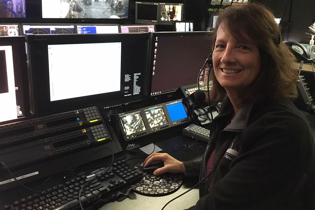
Featured photo: Leslie Sautter on the control room of the Okeanos Explorer.


